|
«The Bernina valley runs from Pontresina in a south-south westerly direction and ends at the Bernina pass, positioned in a wide hollow between Piz Cambrena (3’604 m) and Piz Lagalb (2953 m), from where the Poschiavo valley starts. This valley then divides into two distinct branches, separated by a ridge that goes from Piz Campasc (2599 m) to Motta di Balbanera (1783 m).
The first branch is the Pila valley, which flows into the Cavaglia basin at an altitude of 1693 m. From here it drops, by way of a 600 m downward step, to the San Carlo area. The southern side of the Cavaglia basin is closed by a glacial threshold, which culminates in the Moti da Cavagliola (1742 m). The valley then continues with a 600 m drop ending at San Carlo, where it is joined by the branch that comes from the Laguné valley.
The second branch descends from the lateral depression of the Bernina pass to the La Rosa basin (1871 m), where it is joined by the Laguné valley, which in turn starts from the Forcola di Livigno (2315 m). From there it continues downwards towards Sfazù, where the Poschiavino torrent disappears in a narrow gorge and joins the Cavagliasco torrent at San Carlo».
(Aldo Godenzi) |
 |
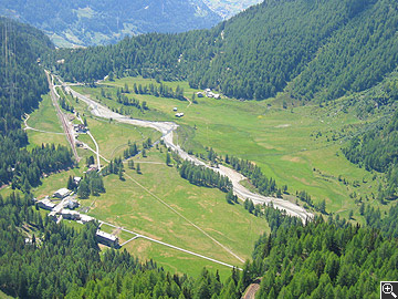
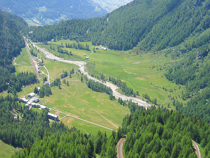
The Cavaglia basin and glacial threshold together with the village of Cavaglia and its railway station
» Order the red wine | » Order the white wine
 1
| 2 | 3 1
| 2 | 3

|
|
|